Dundas
The Dundas Project form part of an underexplored green fields region in the Albany Fraser Belt. In 2005, the discovery of the multimillion-ounce Tropicana gold deposit in 2005, 330 kms east of Kalgoorlie in the Albany Fraser Belt, initiated a reassessment of the prospectivity of the province. A programme of geophysical surveys and geoscientific work, including age dating of rocks, undertaken by the Geological Survey of Western Australia, during 2006-2010, has subsequently shown the Albany Fraser belt to contain reworked Archaean greenstones.
The Project area is now considered to be situated within the inferred SE extensions of the mineralised Norseman – Wiluna Belt of the Archaean Yilgarn Craton and comprises a tectonostratigraphic assemblage of mafic, ultramafic and sedimentary dominated units. A major northwest trending fault system transects the tenements and may represent southeast extensions of the prolifically mineralised and regionally continuous Zuleika and Boulder-Lefroy Fault systems, illustrated in Figure 1.
The Boulder-Lefroy Fault Zone (BLFZ) is remarkable for the number of structurally controlled gold deposits that it hosts. These include the following gold districts (with tons of contained Au): St Ives (253 t), Hampton-Boulder-Jubilee (123 t), Golden Mile (1,821 t) plus Mount Charlotte (219 t), and Paddington-Broad Arrow (112 t) 6. Large gold deposits such as Higginsville, Cave Rocks, Frogs Legs, White Foil, Mt Marion occur within the 180 km long Zuleika Shear (ZS).
Only very limited historical exploration has been carried out in the area due to the thin blanket (usually 5 – 10m) of transported cover. One km spaced auger soil traverses undertaken by AngloGold Ashanti Australia (AngloGold) and a localised RAB/RC drilling program by Pan Australian Resources during the 1990’s has identified the presence of gold mineralisation hosted by mafic rocks in E63/2046. Reported intersections include:
T4RC032 2m @ 3.5g/t Au from 23m
T4RC042 1m @ 2.1g/t Au from 87m
The mineralisation remains open, and the associated Au and Cu soil geochemistry (AngloGold’s data) suggests the mineralisation is much more extensive than indicated by past drilling. Several large and robust gold in soil geochemical anomalies, up to 6 kms in length, are spatially associated with the interpreted BLFZ in E63/2048 and represents a high priority for drilling for Shree Minerals (Figure 1).
Greenstone belts are commonly hosts to gold and rare-element pegmatites because they are both products of collisional tectonic processes. Rare-element pegmatites form in orogenic hinterlands related to plate convergence. The pegmatites are products of extreme fractional crystallization of some granites, derived from melting of metasedimentary rocks in continental collision zones. The world class Buldannia Lithium Project (Liontown Resources) is situated just 25 kms northwest of Shree’s tenements., illustrated in figure 1.
Within Shree’s tenement areas, Pegmatitic intrusions have been recorded in the historical drilling, illustrated in Figures 1, 2 & 3.
Air core drilling is planned to test the identified lithium pegmatite potential and gold anomalies, in the southern portion of the tenement E63/2046, figure 3.
Location Map
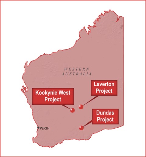
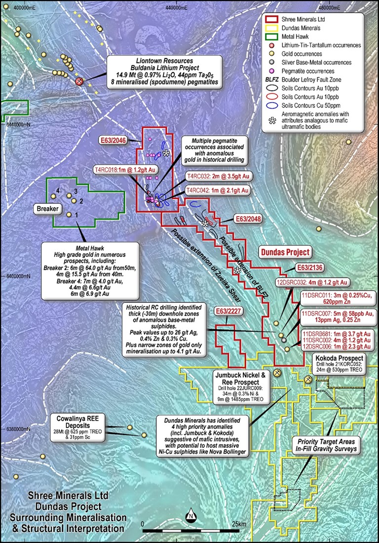 Figure1. Historical data summary of Shree’s E63/2046, E63/2048, E63/2136, E63/2227. The location of the BLFZ and the ZS is interpreted from the aeromagnetic data. Also illustrated are the pegmatite occurrences recorded in historical drilling logs. Soil geochemical contours up to 5 kms in length and anomalous drilling intersections are also shown. Underlying image is the regional aeromagnetic image.
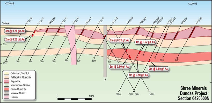 Figure 2. Historical RC drilling in Shree tenement E63/2046. A mixed pegmatite-gneiss horizon is interpreted to exist stratigraphically above anomalous gold in a biotite quartzite.
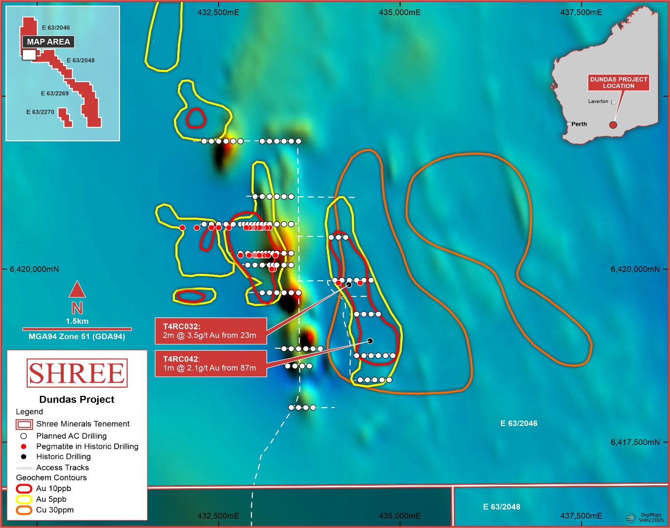 Figure 3. Air core Drilling plan (red dots) for southern portion of the tenement E63/2046. The background image is of the aerial magnetics.
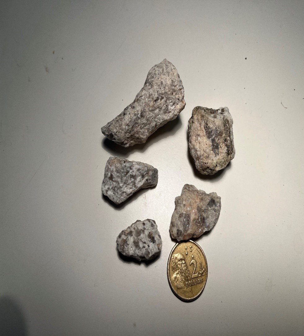 Pegmatite chips found in old drilling spoil during reconnaissance mapping, by Shree in 2022.
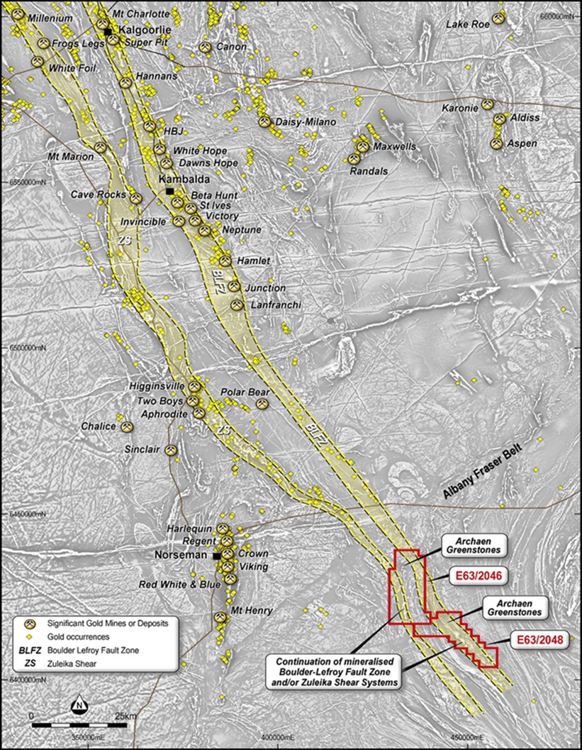 Regional interpretation of aerial magnetic data, showing strike extent (yellow tint) of the Boulder Lefroy Fault Zone (BLFZ) and the Zuelika Shear Zone (ZS) into Shree’s initial tenement package.